Project Implementation
Project Implementation
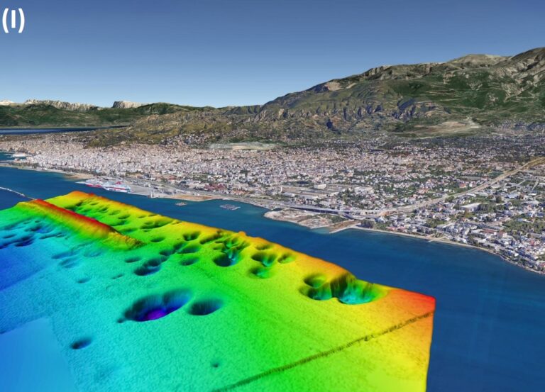
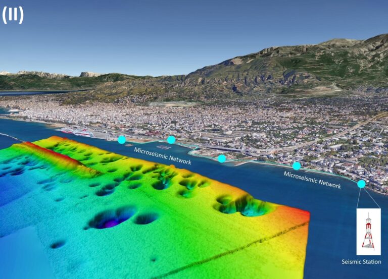
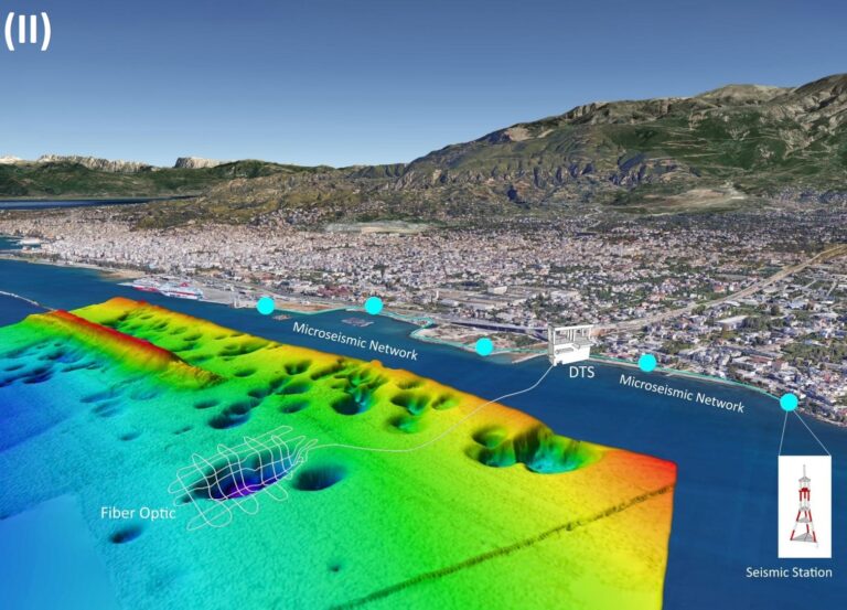
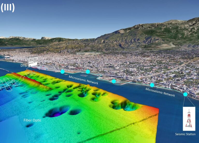
In order to achieve its purposes, BLUEL will monitor in long-term the field of pockmarks in the Gulf of Patras through:
(i) Detailed mapping of the pockmark field using marine remote sensing techniques
(ii) Measurements of seismic activity from the deployment of a microseismic monitoring network around the pockmark field,
(iii) Measurements of temperature just above the seafloor by the deployment of a Distributed Temperature Sensors (DTS) system on the seabed of a specific pockmark and
(iv) Chemical analysis of samples of seawater and sediments collected from the field of pockmark in order to define the chemical composition and the origin of emitted gas.