Project Start
Kick-off meeting
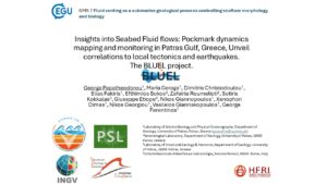
The Kick-off meeting of the BLUEL project, took place on 1st of March 2020 (PI) gave an overall presentation of the project, the partners talked about their contribution to specific Work Packages (WP) of the project and the timetable of the actions to be done within the first semester was thoroughly discussed. Finally, there was a brief reference on the build up and content of the project's website"
2 Prof. joined the BLUEL group
Asc. Prof. Sotiris Kokkalas will work on the tectonic regime of the area and Ass. Prof. Zafeiria Roumelioti will work on the microseismic network around the Patraikos Gulf.
Progress meeting
In order to evaluate the progress of the project during the first trimester of its life, a virtual meeting of the consortium took place on 11th of June, 2020. A detailed discussion about all the WPs was made and an extension of some deliverables of the project was decided, due to the outbreak of the COVID 2019 pandemic which influenced the normal flow of the project. Finally, the first marine remote sensing survey was set to be done during the summer of 2020“.
Welcome Nikos and Georgia
Nikos and Georgia have just joined our group! Nikos will work on the processing and interpretation of marine geophysical data and Georgia on the deployment and operation of microseismic network.
Marine remote sensing survey
Detailed marine remote sensing survey carried out at area of the pockmark field of Patras Gulf. Multi-beam Echosouder, Side Scan Sonar and high-resolution subbottom profiler utilized in order to map in deal the pockmark field. The collected data will be compared with older data from the area collected from the same area by the Laboratory of Marine Geology and Physical Oceanography.
Installation of three seismic stations
Installation of three seismic stations (KRI, KDN and GBTAS) for the establishment of a microseismic monitoring network around Patras Gulf pockmark Field. The KRI and KDN
In-situ methane measurements and sediment sampling
At selected locations in the pockmark field, methane (CH4) measurements were performed on site in the water column using a metered methane metering sensor METS In addition to finding the composition of the fluids escaping from the bottom and their isotopic composition with the ultimate goal of identifying their origin, a water sample was collected for gas analysis.
Sediment cores were sampled with a short KC Kajak (80cm) core at selected locations, based on the results of the systematic marine geophysical survey. The sites, inside and outside the pockmarks, were selected to determine if sediment chemistry was controlled by fluid leaks. The sediments were analyzed to determine their granulometric and geochemical composition.
Marine remote sensing survey
A detail marine remote sensing survey took place in the pockmark field, four days after an earthquake of magnitude M=4.9 at 6:40 on February 17th, 2021. The survey was designed to define if the pockmarks were activated due to the seismic event. The marine survey used: (i) an ELAC Nautic Seabeam 1185 multibeam echosounder system (MBES), (ii) an Edgetech side scan sonar tow-fish in association with an EG & G Model 260 processor and (iii) a CHIRP subbottom profiling system with a 4 array transducer. Positional and navigation data was provided by a Differential Global Positioning System (DGPS). High reflectivity plumes were detected in the water column rising from the pockmarks and the active faults of the area. The geophysical data is under process.
Deployment of Monitoring Station
SILIXA DTS (Disturbed Temperature Sensors) system deployed to measure seawater temperature on the seabed along a 250-fiber optic cable. The DTS station installed at the north of the South Patras Port and the cable deployed by divers. The deployment site selected based on the results of the geophysical survey in order to pass over a pockmark formed at the footwall of Agia Triada fault. Temperature data is collected every 10 seconds along the fiber optic cable and sent via a wifi network to a workstation installed in Patras Port Authority SA facilities.
Installation of three seismic stations
Installation of another three seismic stations (BLU2, ΑΡΛΑ and VASI) for the completion of the microseismic monitoring network around Patras Gulf pockmark Field.
In Situ methane measurements
In situ methane (CH4) measurements, were performed at selected locations, in the water column using a methane sensor. In addition, CTD data was collected at the same positions.
Marine Remote Sensing Survey
Detailed marine remote sensing survey carried out at the area of the pockmark field after the 4.1R on July 16th earthquake. The survey was designed to define if the pockmarks were activated by the seismic event. Two Side Scan Sonar systems were utilized, the EG&G 272 TD and the Edgetech 4200SP.
Final Event
On Monday, July 24, 2023, the final event for the presentation of the outcomes of the project BLUEL was held in the Conference & Cultural Center of the University of Patras.
Deputy Mayor of Patras N. Aspragathos, Deputy Regional Governor of Western Greece F. Zaimis, vice-Dean of the University of Patras V. Vassiliadis and Head of the Geology Department of the University of Patras P. Xipolias attended the event and addressed the participants with a welcome speech.